
THEME
Dream tour
START
‘Thorpark’, Gateway to the Hoge Kempen National Park
Thorpark, André Dumontlaan 67, 3600 Genk. See Google Maps
The information board is set up at the start point.
END
Same place
LENGTH
16,3 km
DIFFICULTY
Moderate (Wear sturdy footwear)
DESCRIPTION
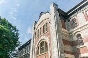
The trail starts at the Gateway Thorpark. Be aware of the impressive architecture of the historical mine building. This building was the headquarters of the Waterschei Mine. Now this is one of the gateways to the National Park with service points and conference rooms. Short after starting you pass the ‘Waterschei Schans’. In the 16th century, the area of the Kempen was regularly the target of enemy armies. The Kempen villages did not have many moated castles to take shelter. That is why the population tried to protect themselves by making fortifications. These were areas, surrounded by an earthen wall and a wide moat, where residents could retreat to small temporary homes. The fortress could be closed via a drawbridge. Here you see a reconstruction of the ‘Waterscheischans’.
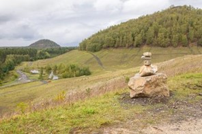
The first part of the trail passes the Stiemerbeekvalley and a pond, the Hornszee. After the cross of the ‘Kolenspoor’ you climb up the stairs to the first level of the slag heap/Terril Waterschei. The landscape is more open with multiple water ponds. After that, you climb up to the second level of the slag heap with a stunning viewpoint. If wanted there is the possibility to climb to the third level of the slag heap with a 360° impressive view of the National Park Hoge Kempen and the wider area of Limburg. While descending the slag heap, the landscape scenery changes into a birch forest.

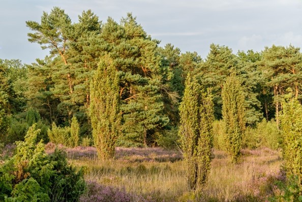
While leaving the birch forest, the trail will lead you to the ‘Heiderbos’. This landscape is a beautiful heathland with juniper trees (juniperus). Halfway the Heiderbos there is a nice view on a lake which was a former sand quarry. Next to this lake, there is a landscape artwork ‘Don’t start the fire’.
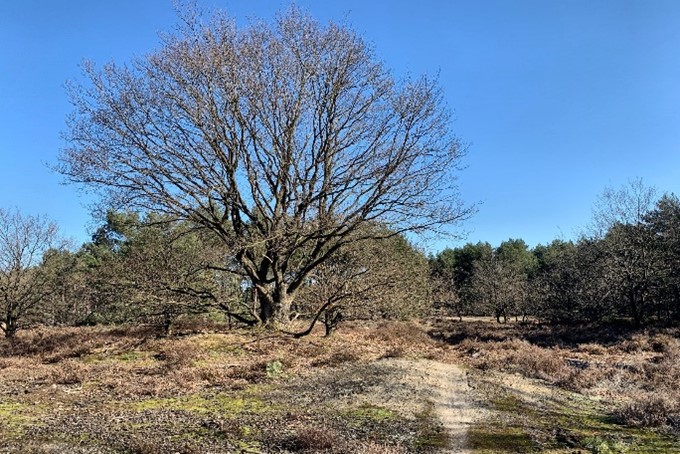
In the beginning of the third section, you leave the Heiderbos. From here you walk several kilometers into the forest on your way to ‘Opglabbekerzavel’. Before reaching this heathland we pass an open Land Dune with a beautiful old oak tree. After passing the heathland of ‘Opglabbekerzavel’ the trail leads back to the Slag heap/terril of Waterschei with a view of water ponds. On the slag heap the landscape is open. While returning to the endpoint of the trail we pass again the ‘kolenspoor’ and a local landscape artwork ‘lichtsporen’. At the end of the trail, you walk under the shaft towers of the old mine of Waterschei.
MARKING
This trail is signposted with a Yellow sign:

You can advantageously follow the route with a map, a GPS, or a smartphone.
See the links below for the options.
PURCHASING OPPORTUNITIES
You can buy a map in the National Park Visitor Center, Zetellaan 54, 3630 Maasmechelen.
OTHERS
The LQT-Day Walk ‘Top Trail Thorpark’ is made in collaboration with Visit Flanders and the municipalities of Genk and As.
LINKS
Komoot:
Outdooractive (click at Learn More):


 Walk for unity & wellness!


