THEME
Dream tour
START
‘Terhills’, main gateway to the Hoge Kempen National Park, Zetellaan 54, 3630 Maasmechelen
See Google Maps.
The information board is set up at the start point.
END
Same place.
LENGTH
10 km
DIFFICULTY
Moderate (Wear sturdy footwear)
DESCRIPTION
Where 26 years ago, the Eisden coal mine was working at full capacity, the rarest butterflies are now fluttering. You can enjoy a surprising landscape of ‘hills and lakes’ and hilltops with spectacular panoramas!
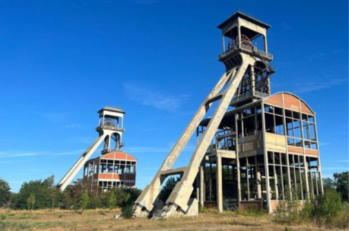
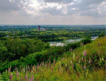
The Red trail starts at the 2 Shaft towers reminding of the Coal mining history. In less than one decade the Coal Mining history in the Hoge Kempen changed the landscape drastically. The Coal Mine was discovered in 1901. The last Coal Mine (Eisden) closed in 1989. in these 90 years, the landscape made a turnover from ‘rural’ scenery with mainly heathlands, fens, and land dunes into ‘industrial’ scenery, with shaft towers, slag heaps, Pine forests for wood yields to construct mine galleries, and quarries for raw materials. After the towers you climb the first slag heap ‘lange terril’. This slag heap has a mainly open landscape with 2 viewpoints. The first viewpoint gives a view of the typical ‘Eisden Garden City’, specially built by the coal mine company to host mineworkers. The second viewpoint gives a stunning view of the National Park Hoge Kempen.
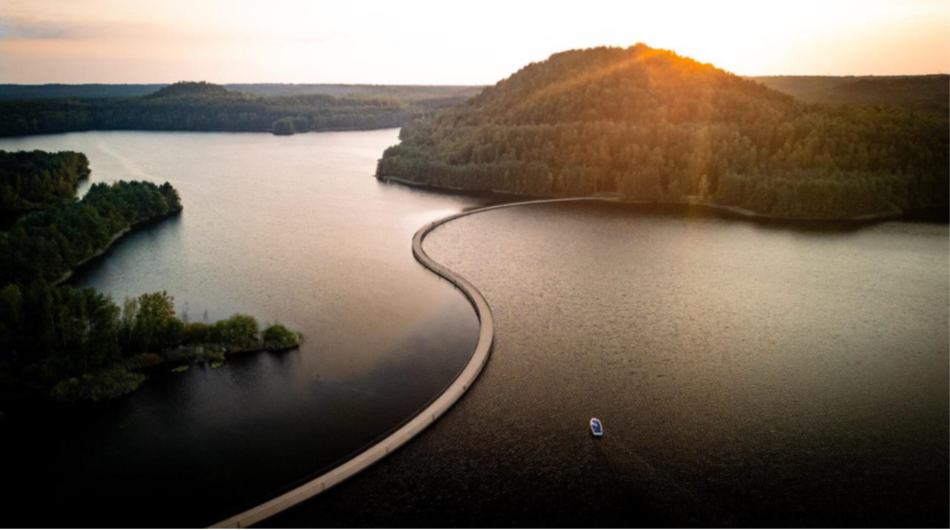
After descending the first slag heap ‘Lange terril’ you reach the lake (Grote Plas). Walking on a spectacular bridge you cross the lake ‘Grote Plas’ and reach the second slag heap ‘Dubbele terril’. The climb on this slag heap is much steeper than the first one. On your way up you also see a historical ‘mine building ruin’ where mine waste and material was stocked before bringing and dumping it on the slag heap. The landscape type on this slag heap is closer to Pine Forest with a viewpoint on the top. You can see a third slag heap (red terril) and slag heaps in the wider area in Genk (Thorpark).
After (a steep) descending of the slag heap ‘dubbele terril’ the red trail runs beside the lake ‘grote plas’. After leaving the water the trail leads back to the starting/end point, the National Park Visitor Center.


MARKING
This trail is signposted with a Red triangle sign:

You can advantageously follow the route with a map, a GPS, or a smartphone.
See the links below for the options.
PURCHASING OPPORTUNITIES
You can buy a map at the National Park Visitor Center, Zetellaan 54, 3630 Maasmechelen
See Google Maps.
OTHERS
The LQT-Day Walk ‘Terhills Red Trail’ is made in collaboration with Visit Flanders and the municipalities of Maasmechelen and Dilsen-Stokkem.
LINKS
Outdooractive


 Walk for unity & wellness!


