

Route
Main link: baltictrails.eu
The Baltic Coastal Hiking Route
Name in Lithuania: Jūrų takas
Name in Latvia: Jūrtaka
Name in Estonia: Ranniku matkarada
In the Baltic States, the ~ 1420 km long Baltic Coastal Hiking Route is the first long-distance hiking route that crosses all three Baltic States. The hiking route is part of E9 and it starts at the Lithuanian-Russian border in the village of Nida in Lithuania, leads through Latvia, and finishes at the Port of Tallinn in Estonia; the route can be made in both directions and Tallinn can also be a starting point.
In Lithuania, the Baltic Coastal Hiking Route crosses Curonian Spit National Park, one of the most unique parts of the Baltic Sea coast with high dunes (up to 20 m altitude on the route) and surprising sand formations created by the wind. The Curonian Spit is included on the UNESCO World Heritage List. Nemunas Delta Regional Park, known as the “bird paradise”, is a famous site of migratory and nesting birds. The popular beaches of Klaipėda and Palanga alternate with the wild seashore in Pajūris Regional Park.
In Latvia, the Baltic Coastal Hiking Route goes through the Pape Nature Park, along the bluffs between Pāvilosta and Sārnate, and leads you to Slītere National Park with Cape Kolka which separates the Baltic Sea and the Gulf of Riga and is one of the most popular bird-watching sites on the Baltic seacoast. On the Western coast of the Gulf of Riga, present-day fishing villages and small yacht ports are located one after another. In Ķemeri National Park you can get to know historic fishing villages. The Jūrmala resort city, is characterized by unusual wooden architecture, and Riga Old Town – is a UNESCO World Heritage site. The Vidzeme coast is the most multifaceted section of the route in Latvia, which includes both sandy and rocky beaches, coastal meadows, reeds, dunes, sandstone outcrops, forests, capes and small coves, fishing villages, pubs, and estuaries of small rivers.
In Estonia, the Baltic Coastal Hiking Route goes to Pärnu – a popular resort city – and leads through Matsalu National Park, the largest wetland in Northern Europe. In the coastal resort of Haapsalu, the route takes pedestrian sidewalks and seaside promenades. The littoral of the Gulf of Finland is the most multifaceted section in Estonia with boulders, sandy beaches, grassy coastal meadows, and the so-called breccias: pieces of rocks that have resulted from an ancient meteorite explosion. Pakri Cliff is the most spectacular coastal cliff wall in the Baltic States reaching a height of 24 m. Many military heritage sites around Tallinn include coastline fortifications and coastal protection batteries. The Medieval Old Town of Tallinn is a UNESCO World Heritage Site. Western Estonian islands are situated close to Baltic Coastal Hiking.
Trail surface
In Lithuania, Baltic Coastal Hiking mainly goes along sandy beaches and dunes, small forest trails, and seaside meadows on the Curonian Lagoon side.
In Latvia, Baltic Coastal Hiking mainly involves sandy beaches, rocky beaches in some places, and short stretches through coastal meadows. Sandy dune habitats are characteristic of the Latvian coast. Well-trodden trails and small roads are also present in the seaside forests.
In Estonia, Baltic Coastal Hiking goes along the seashore for around 100 km, mainly between Haapsalu and Tallinn. In other places, crossing the coastline becomes difficult as it is shaped by numerous capes, peninsulas, wetlands with reeds, floodplains, lagoons, and shallow coves. This is why the remaining distance of around 500 km has to be covered via seaside trails, roads, and country roads.
Baltic Coastal Hiking goes along pedestrian pavements in all three countries in cities and populated areas.
Starting Point
Lithuania, Nida
End Point
Harbour, Tallinn – the capital city of Estonia (no informationboard presently at the harbour)
Which cities and towns does the E-path pass-through
Lithuania: Nida (Neringa) – Klaipėda – Palanga – Šventoji (and a branch of the trail along the Curonian Lagoon: Rusnė – Šilute – Klaipėda)
Latvia: Nida – Liepāja – Ventspils – Cape Kolka – Jūrmala – Rīga – Saulkrasti – Ainaži
Estonia: Ikla – Pärnu – Virtsu – Lihula – Haapsalu – Paldiski – Tallinn
Length
The total length of the route is ~ 1420 km, of which 216 km are in Lithuania, 581 km are in Latvia, and 622 km in Estonia.
Ground path of the E-path
Some parts of the Baltic Coastal Hiking coincide with hiking trails and other tourist routes in Curonian Spit, Slītere, Ķemeri, and Matsalu National Parks.
Responsible organizations
Responsible partner in Latvia:
Latvian Rural Tourism Association “Lauku Celotajs”/ Baltic Country Holidays
Ph. +371 29285756
Riga, Kalnciema str. 40, Latvia
asnate@celotajs.lv
www.countryholidays.lv
Responsible partner in Lithuania:
Lietuvos kaimo turizmo asociacija / Lithuanian Countryside tourism association
K. Donelaičio g. 2-201, LT-44213 Kaunas
web: www.atostogoskaime.lt
email: info@atostogoskaime.lt
Responsible partners in Estonia:
Eesti Matkaliit MTÜ (EML, The Estonian Ramblers´ Association)
Liiva 5, EST-11622, Tallinn, Estonia
Ph: +372 5281747
info@matkaliit.ee
www.matkaliit.ee
MTÜ Eesti Maaturism / Estonian Rural Tourism association
Vilmsi 53g, 10115, Tallinn
Ph: +372 6009999
eesti@maaturism.ee
www.maaturism.ee
Publications
- Guide – Baltic Coastal Hiking route in Latvia/Estonia
- Image brochure with overview map – Baltic Coastal Hiking route in Latvia/Estonia
- Baltic Coastal Hiking Tour Manual in Latvia/Estonia
- Handbook for tourism professionals
- Marking guidelines for the hiking route along the Baltic Sea coastline in Latvia and Estonia
- Visual identity guidebook
All publications are available here: baltictrails.eu/en/coastal/publications
Please see all the marketing materials developed for Baltic Coastal Hiking here: baltictrails.eu/en/coastal/marketing
Maps
baltictrails.eu/en/coastal/map
Marking system
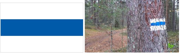
There are markings (white – blue – white) on trees, stones, and other nature objects and Baltic Coastal Hiking route stickers on road signs, electricity poles, and bridge parapets in villages and cities, and reference road signs. It is not marked in places where Baltic Coastal Hiking goes along the beach and continues straight forward for a long distance. You will also see information stands placed along Baltic Coastal Hiking.

Crossing other E-paths
Overlaps E11 (Forest Trail) in Bigauņciems-Rīga (~53 km), Latvia
Crossing E11 (Forest Trail) in Riga
Connects to E11 (Forest Trail) in Tallinn
Practical
The route is divided into ~ 20 – 25 km long single-day hiking route stages with accommodation and transport options.
Accommodation
The number of accommodations varies in the different sections of the sea coast. You will find information about the accommodations in the description of each section of the itinerary under “Services” (baltictrails.eu/en/coastal/itinerary). It is advisable to book them on time, because the ones next to the sea may be fully booked during the tourism season.
Food
The number of catering providers varies in the different sections of the sea coast. You will find information about the catering in the description of each itinerary section under “Services” (baltictrails.eu/en/coastal/itinerary). Some enterprises only operate in the summer, which is why it is safer to call in advance.
Shops can be found in the more populated areas, but some sections have no shops within a day’s walk. Information about this is indicated in the description of each section of the itinerary under “Services” (baltictrails.eu/en/coastal/itinerary).
Travel
Public transport is available in most parts of the sea coast (most often buses, trains are less common), but their timetables have to be checked in advance:
- for Lithuania, visit www.autobusubilietai.lt, www.traukiniobilietas.lt,
- for Latvia, visit www.1188.lv/satiksme,
- for Estonia, visit www.peatus.ee, www.tpilet.ee.
City public transport is accessible in Klaipėda, Palanga, Liepāja, Ventspils, Jūrmala, Rīga, Pärnu, Haapsalu and Tallinn.
You can get to the Curonian Spit by ferry from Klaipėda to Smiltynė: www.keltas.lt
You can get to the Estonian islands by ferry: Kihnu, Vormsi (www.veeteed.com), Saaremaa, Hiiumaa (www.praamid.ee). Pre-booking is required to Osmussaare (www.osmussaar.ee – in Estonian, +372 5866 9980 Osmussaare Reisid).
Gear
When going through stony and rocky sections, you should wear closed footwear, while in places with an overgrown coast, water-resistant footwear will come in handy. Water and wind resistant clothing will also prove useful.
A medical kit is advisable. You will need a power bank for your phone as there are several long sections where it is not possible to charge electrical devices.
Links
The Baltic Coastal Hiking Route: baltictrails.eu/en/coastal
To make the most of your trip, ask advice from professional rural tourism associations – experts in rural holidays:
www.countryholidays.lv – Latvia, Lithuania, Estonia
www.maaturism.ee – Estonia
www.atostogoskaime.lt – Lithuania
General country information:
www.visitestonia.com – official tourism website of Estonia
www.latvia.travel – official tourism website of Latvia
www.lithuania.travel – official tourism website of Lithuania
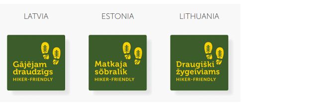
There is created united “Hiker-friendly” criteria and labels for tourism service providers in all three Baltic countries to increase the quality of tourism services offered to hikers. You can recognize “Hiker-friendly” service providers by this label:
References
https://www.era-ewv-ferp.org/latvia
Social media:
- In LT: www.facebook.com/baltictrailsltmiskotakasjurutakas
- In LV: www.facebook.com/jurtaka/
- In ET: www.facebook.com/rannikumatkarada
- YouTube: www.youtube.com/channel/UCBIkg2_P8Gz2NFkNL5AfRlw
- Instagram: www.instagram.com/jurtaka/
 Walk for unity & wellness!


